VisVic Groundwater 3D Visualisation
07 September, 2015

Adapting new technologies to sustainably manage groundwater

A team of researchers, led by Federation University Australia, has created a web portal that transforms the way groundwater data for Victoria is accessed and shared.

Access to AARNet has enabled researchers collaborating on the Visualising Victoria’s Groundwater (VVG) project, led by Federation University Australia (FedUni), to demonstrate the value of high-speed broadband in an innovative way.

A multidisciplinary team has created a web portal that federates groundwater data from multiple sources for the State of Victoria, Australia. The portal assists water managers, farmers, researchers, catchment managers and other groundwater users with decision-making for the sustainable use and management of this precious resource.

“Groundwater is one of those things you can’t see so it’s surrounded by a lot of myths. The only way you can find out about groundwater is to drill a bore and collect data,” said VVG project manager and FedUni hydrogeologist Peter Dahlhaus.

He says while groundwater data has been collected for more than 130 years in Victoria, the datasets have been scattered across various government departments and other institutions, making comprehensive information difficult to collect.

The VVG portal solves the problem by enabling remote access to all the datasets (currently 79 datasets from six disparate repositories) and seamlessly integrating the interoperable web services they each provide.

“The beauty of interoperability is that you can bring data together. For example, you can look at a bore and get access to all sorts of linked information that you didn’t know existed, from government datasets to chemistry data at a uni and photos in the state library – it’s just fantastic,” says Dahlhaus.

Researchers developed the VVG portal using open-source and standards-compliant software, building on previous research to provide users with tools and applications that are fast, intuitive and easy-to-use.

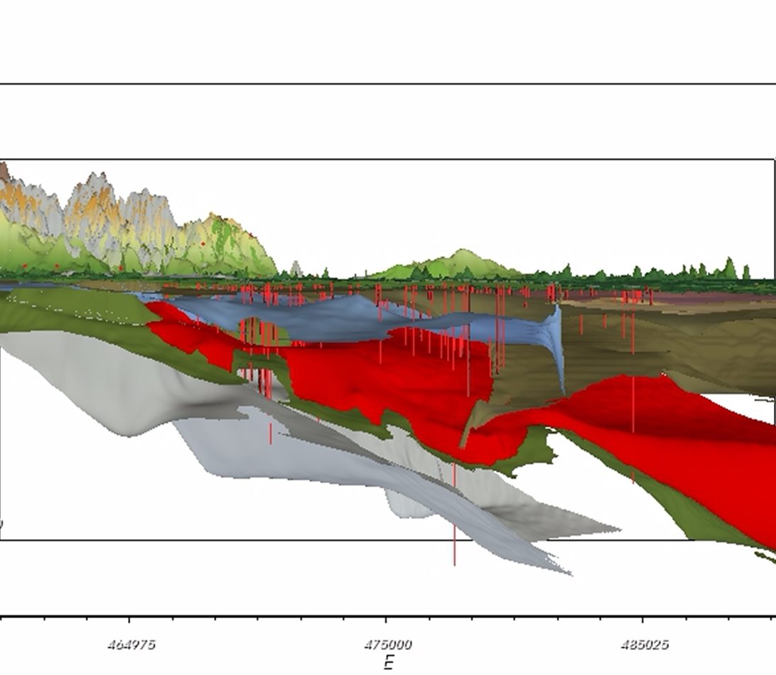
Users click on the portal’s dynamic geospatial map to zoom in on a farm or district or view the entire state. The portal’s 3D visualization tool, developed in collaboration with researchers from Queensland University of Technology (QUT) is an adaptation of QUT’s Groundwater Visualisation System and enables users to select views of layers and cross-sections of the surface of the landscape, aquifers or beds below. The performance of the map and visualisation tool is dependent on a high-speed broadband connection.

Dahlhaus says with one-stop access to information about aquifers, how deep to drill and groundwater quality, water managers are now able to make more informed decisions about where to drill bores.

“It’s changing the way people do their work and making the process of issue resolution more efficient. For researchers, easy access to data that wasn’t available before has created opportunities for new discoveries within the data itself,” he said.

An analysis of the impact of implementing the VVG revealed that ease of access and the quality of data are drivers for its growing use and viability as a sustainable means for accessing information.

The same technique is now being used to pull together data for other applications, including planning for fire management, sport and recreation and agriculture.

The VVG project is an example of how access to the AARNet network removes the barriers to innovation for the scientific community.

It’s changing the way people do their work and making the process of issue resolution more efficient. For researchers, easy access to data that wasn’t available before has created opportunities for new discoveries within the data itself.”

Federation University
Peter Dahlhaus

VVG project manager and FedUni hydrogeologist