Monitoring marine life
09 March, 2015

Collaboration spawns new eResearch tools for monitoring marine life

AARNet infrastructure underpins a groundbreaking system enabling researchers to quickly and easily upload, organise, categorise and share photo data from field trips.

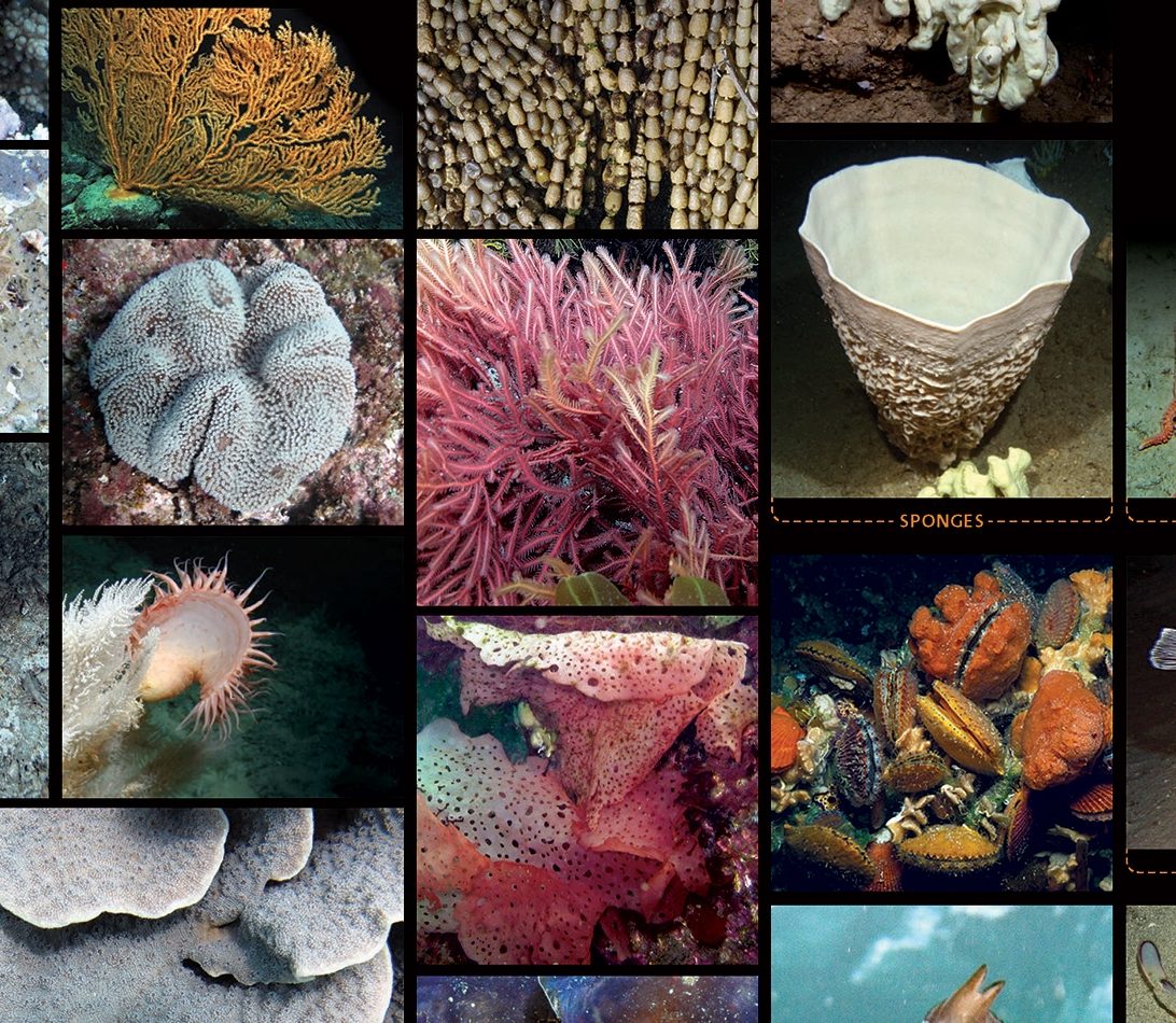
Researchers now have a system for identifying and naming marine flora and fauna pictured in underwater photographs and videos, marking a huge step forward in the way the marine environment is examined and monitored.

The Collaborative and Automated Tools for Analysis of Marine Imagery (CATAMI) project (funded by the National eResearch Collaboration Tools and Resources (NeCTAR) and supported by the Australian National Data Service (ANDS), developed the system, which provides researchers with tools enabling them to quickly and easily upload, organise, categorise and share photo data from field trips.

The CATAMI data collection is stored at Pawsey Supercomputing Centre in infrastructure provided by the federally funded RDSI Project. The wider research community accesses and shares the data as well as collaboration tools over AARNet’s high-speed optical network infrastructure.

Providing researchers with an efficient way to examine and monitor marine habitats

Australia has an extremely large marine territory but a limited number of marine researchers to monitor and map the underwater benthic habitat. (Benthic is the study of the organisms living in and on the sea floor, the interactions between them and impacts on the surrounding environment).

Photographs and video provide a safe, non-destructive and efficient way to examine and monitor marine habitats. The traditional approach has been to collect vast amounts of imagery then manually ‘score’ or label biota and substrate within the image. With the volume of collected imagery rapidly increasing every year as technology improves, manual scoring became unsustainable.

“We had a huge issues managing the massive amounts of images. Comparisons across disparate sites as well as further abstraction are very difficult without a standardised approach to the classification and analysis of this imagery, ” said Australian Institute of Marine Science (AIMS) spatial modeller Dr Ben Radford.

Marine researchers across many organisations contributed to the project

To assist marine ecologists in making this process more efficient the CATAMI project was created. The project team from the Pawsey Supercomputing Centre in collaboration with the Marine Science community, developed both software and assisted in the development a standard classification scheme.

The development of classification scheme by marine researchers across many organisations employs a standardised combination of high-level taxonomy (phylum, order, class) and morphological (shape, growth-form) characteristics that can be determined from a picture. The National Environmental Research Program (NERP).

Dr Radford says this approach using imagery provides greater consistency than existing classification approaches and can be readily adopted by a wide range of stakeholders.

“Researchers can now collectively view and analyse data in a standard way leading to far better and faster habitat assessment and monitoring which help to inform management decisions. It also means that scientists can collaborate better on research throughout Australia, “ he said.

Helping researchers asses the impact of development and climate change

CATAMI tools are helping Australia’s marine ecologists to transform raw underwater imagery into powerful quantitative information for broad range of applications such as routine monitoring, assessing the potential impact of development or climate change and for habitat assessment in marine park areas.

CATAMI has been increasingly adopted by industry, government and academia, which will enable data sharing and re-use of annotations from multiple organisations, providing the opportunity for new, broad-scale scientific questions to be answered.

CATAMI's resources are playing a unique role in assisting researchers to better monitor Australia’s oceans and ensure they are used in a sustainable manner. Increasing quantities of data will continue to be uploaded, transferred and replicated and the AARNet network plays a critical part in this process.”

Australian Institute of Marine Science
Dr Ben Radford

Australian Institute of Marine Science